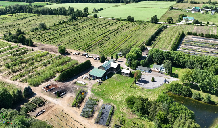
Landscape Scans
Challenge
The company was grappling with the inability to accurately visualize and map the distribution of various vegetation types across their extensive landholding. This lack of detailed spatial understanding hindered effective land use and development planning.
Solution
Ironfin addressed this challenge through advanced photogrammetry and aerial drone technology, capturing high-resolution imagery of the terrain. These efforts culminated in ultra-high-resolution printouts and sophisticated 3D models that offered an unprecedented level of detail and clarity. By meticulously processing these images, Ironfin provided a comprehensive and tangible overview of the landscape, including precise locations of different vegetation types.
Impact
The delivery of ultra-high-resolution imagery and 3D models transformed the company's approach to land use planning and development. Stakeholders gained a detailed visualization tool that enabled accurate planning and decision-making, ensuring that development efforts were informed by a thorough understanding of the land's current state. This project not only facilitated a deeper engagement among stakeholders but also underscored Ironfin's commitment to leveraging cutting-edge technology to solve complex visualization challenges, promoting informed and sustainable land development strategies.