Culverts & Waterways: Preserving Natural Flow Amid Development
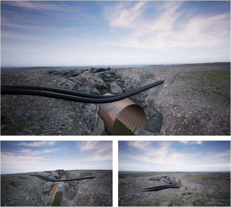
Maintaining the delicate balance between land development and environmental preservation is a challenge faced by many communities. In this project, 3D visualizations were used to illustrate how carefully placed roads and culverts could ensure uninterrupted water flow through streams and rivers. These dynamic visual representations detailed the integration of culverts into the landscape, demonstrating their role in preventing erosion, managing water levels, and sustaining local ecosystems. By providing a clear picture of the project’s design, the visuals effectively conveyed the foresight and care taken to minimize environmental impact.
Community members were able to see, in vivid detail, how these measures would protect waterways while allowing for necessary infrastructure development. The visualizations made complex engineering concepts accessible, showing how culverts would channel water safely under roads without altering the natural flow of streams or rivers. This transparency reassured residents that their concerns for the land, wildlife, and water quality were being taken seriously, fostering trust and collaboration between the developers and the community.
Ultimately, this approach not only demonstrated the project's technical soundness but also emphasized its alignment with community values. The 3D visuals helped bridge the gap between technical experts and residents, ensuring that everyone could engage meaningfully in discussions about the project. By highlighting the commitment to environmental stewardship, the project set a precedent for how development can coexist harmoniously with nature, leaving both the land and its inhabitants in a better position for the future.
LET US HELP YOU
INFORMATION
OUR SHOP
2023 All Rights Reserved. Design by Ironfin